Geoportal
Explore interactive maps and geospatial datasets on land degradation in Africa. Access spatial indicators, statistics, and tools to analyse environmental trends and support decision-making.
Explore maps. Visualize data. Discover insights.
The Geoportal provides access to geospatial data on land and environment in Africa, enabling users to visualize, analyse, and download spatial datasets across the continent.
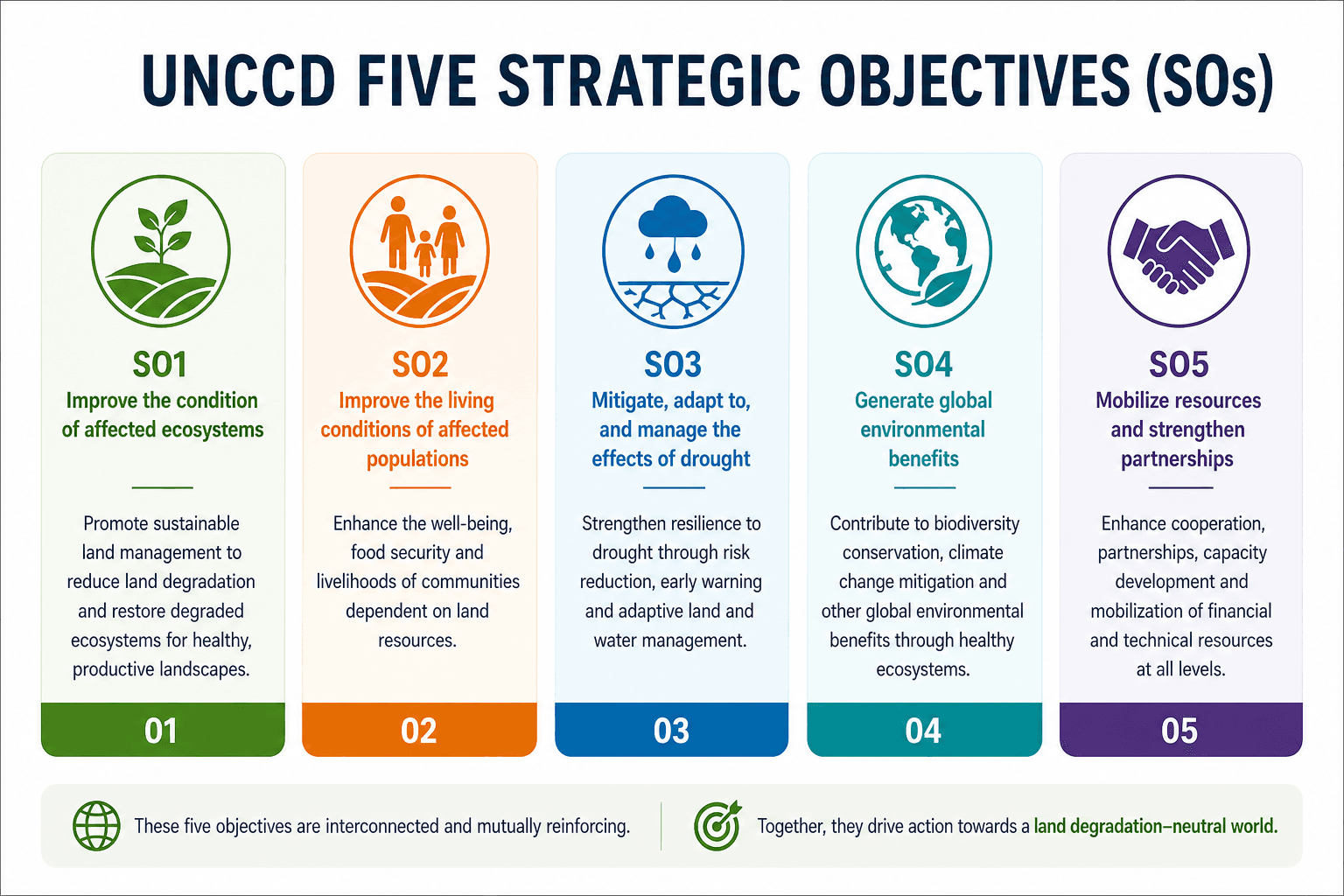
By integrating EO-based environmental indicators and national datasets, the Geoportal offers resources aligned with the UNCCD's four Strategic Objectives (SOs), supporting a comprehensive understanding of land degradation dynamics.
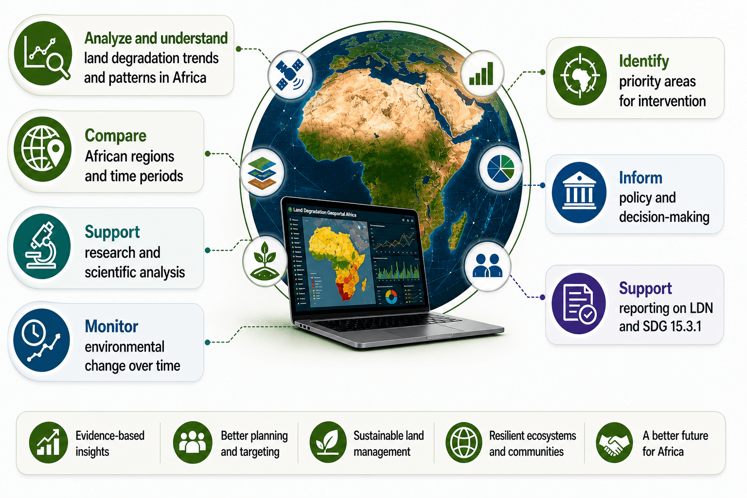
It supports evidence-based analysis and decision-making for sustainable land management at both continental and country levels.
Geoportal's Key features and capabilities
- Land use and land cover, highlighting ecosystems and land dynamics.
- Interactive land degradation maps, highlighting SDG indicator 15.3.1.
- Environmental indicators, covering the UNCCD strategic objectives.
- Vegetation, land, and climate monitoring layers.
- Downloadable geospatial datasets across countries and regions in formats compatible with GIS tools.
What you can do with the geoportal
How to use the geoportal
Get started in a few steps:
- Choose an indicator or dataset
- Adjust the time period
- Visualize results on the interactive map
- Compare thematic layers
- Select a country or region
- Generate the statistics
- Download data or integrate into your analysis