Overview of the Africa Land Degradation Monitoring System | LDN in Africa Platform
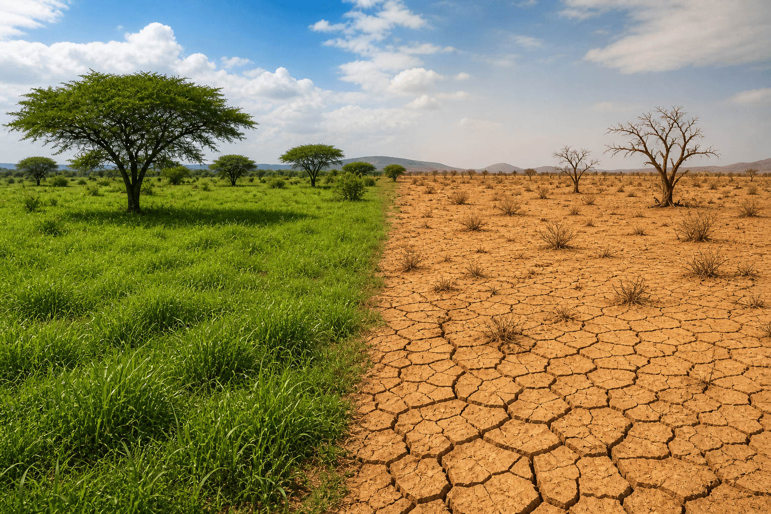
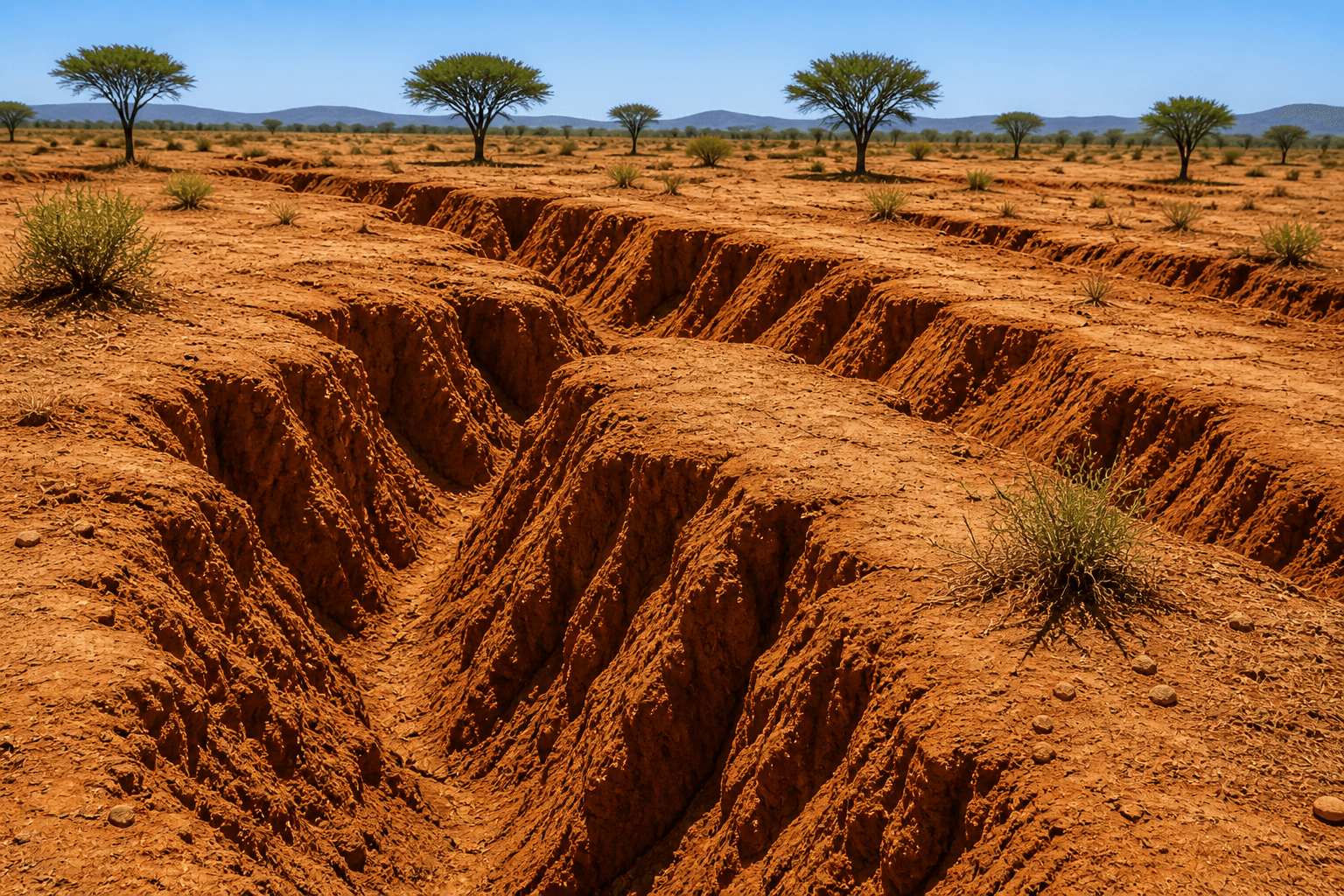
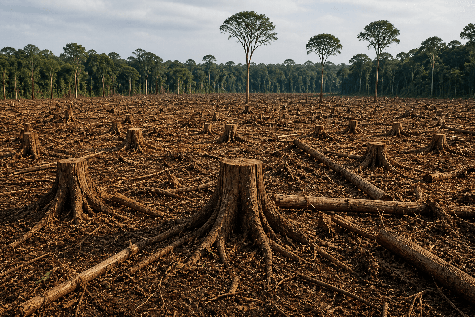
Land degradation is one of the most pressing environmental challenges in Africa, affecting agricultural productivity, water availability, biodiversity, and climate resilience. According to global assessments, Africa loses millions of hectares of productive land every year due to soil erosion, desertification, and unsustainable land use practices.
This platform provides a centralized and integrated system for monitoring land degradation in Africa, enabling countries, institutions, and stakeholders to:
- Track progress toward Land Degradation Neutrality (LDN).
- Monitor SDG indicator 15.3.1 (proportion of degraded land).
- Access harmonized geospatial datasets and indicators.
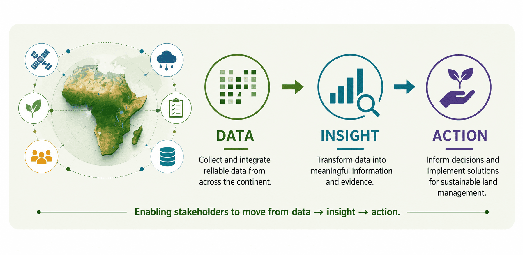
By combining Earth Observation-based data, national information, and analytical tools, the platform supports evidence-based decision-making at national and regional levels.
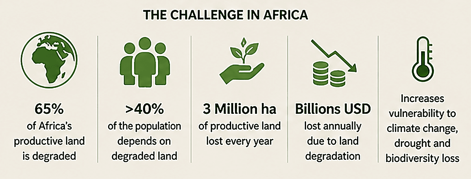
Land Degradation in Africa: Key Facts
of Africa's productive land is degraded (UNCCD estimates).
Nearly 3 million hectares of forest are lost each year in Africa.
Over 40% of the population depends on degraded land for livelihoods.
Land degradation costs African economies billions of USD annually.
Monitoring and reversing these trends is essential to achieving sustainable development and climate resilience.
The Role of the LDN in Africa Platform
The LDN in Africa Platform serves as a centralized system for land degradation monitoring in Africa, integrating environmental, geospatial, and hydrological data into a single access point.
The platform contributes to:
- Improving the accuracy of land degradation monitoring at national and continental levels.
- Supporting sustainable land-use planning and agricultural management.
- Facilitating reporting on Land Degradation Neutrality (LDN) and SDG 15.3.1.
- Strengthening evidence-based decision-making for environmental policies and restoration strategies.
By transforming data into actionable insights, the platform enables stakeholders to better understand land degradation dynamics and take effective measures toward achieving Land Degradation Neutrality in Africa.
Key assets of Africa's Integrated Land Degradation Monitoring System
This system bridges the gap between data and decision-making by providing:
- Reliable and harmonized datasets across Africa.
- Tools for monitoring land degradation trends over time.
- Support for national and international reporting frameworks.
- A shared space for knowledge, collaboration, and innovation.
Enabling stakeholders to move from data to action.
Who is this platform for?
This platform is designed for a wide range of stakeholders involved in land management and environmental monitoring:
Policymakers
tracking LDN targets and national reporting.
Researchers and Scientists
analysing land degradation trends.
NGOs and Development Partners
implementing restoration initiatives.
International Organizations
supporting SDG monitoring and climate action.
Main features of the platform
Continental-scale land degradation data
Derived from EO-derived and harmonized datasets across Africa.
Interactive Geoportal for spatial analysis
Explore land cover, productivity, and soil indicators through dynamic maps.
Dashboards for LDN and SDG 15.3.1 monitoring
Analyse trends, compare countries, and track progress over time.
Resources and methodologies
Access guidelines, tools, and documentation for land degradation assessment.
Success stories and best practices
Learn from real-world solutions implemented across African countries.
Start Exploring
Data sources include OSS, ESA, UNCCD, FAO, EO products, and national datasets.
Events and News
Events Already Held
February 25, 2026
First webinar dedicated to the 2026 Land Degradation Neutrality (LDN) reporting cycle for 22 English-speaking countries.
February 26, 2026
Second webinar dedicated to the 2026 Land Degradation Neutrality (LDN) reporting cycle for 22 French-speaking countries.
March 5, 2026
Workshop – Launch of the Land Degradation and Sustainable Land Management Monitoring System in support of the Great Green Wall Initiative.
March 28, 2026 — Djerba, Tunisia
Workshop to strengthen the reporting of Land Degradation Neutrality, on the sidelines of the Desertif'Actions 2026 International Summit.
Ongoing Events
May 18–22, 2026 — Dakar, Senegal
Regional capacity-building workshop on reporting for Francophone African countries (Annex I Parties).
Upcoming Events
June 15–18, 2026 — Nairobi, Kenya
Regional capacity-building workshop on reporting for Anglophone African countries (Annex I Parties).
The Sahara and Sahel Observatory (OSS)
A UNCCD strategic partner and a regional hub for reporting on Land Degradation Neutrality (LDN)
The Sahara and Sahel Observatory (OSS) is an Africa-focused international organization supporting countries in addressing challenges related to land degradation, climate change, biodiversity, and water resource management.
In April 2026, OSS was designated as a Regional Support Hub to support African countries in reporting on:
- •SDG Indicator 15.3.1 (proportion of degraded land).
- •Land degradation and drought monitoring.
A Technical Engine for Africa
OSS is supporting evidence-based policymaking and contributing to accelerate progress toward Land Degradation Neutrality by leveraging:
- •Earth Observation and Artificial Intelligence;
- •Advanced analytics and digital tools;
- •Experiences from sustainable land restoration regional initiatives.
A Lead of Capacity-Building and Technical Support
In partnership with organizations such as UNCCD, RCMRD, OSS supports:
- •Training and webinars;
- •The 2026 LDN reporting cycle;
- •English and French-speaking countries' focal points and key experts.
Supporting Regional Initiatives
Contact Us
Do you have a question or need assistance?